Dates: 5th July to 7th July 2020
Distance: 50 miles / 80km
Here’s just a brief explanation of what’s going on:
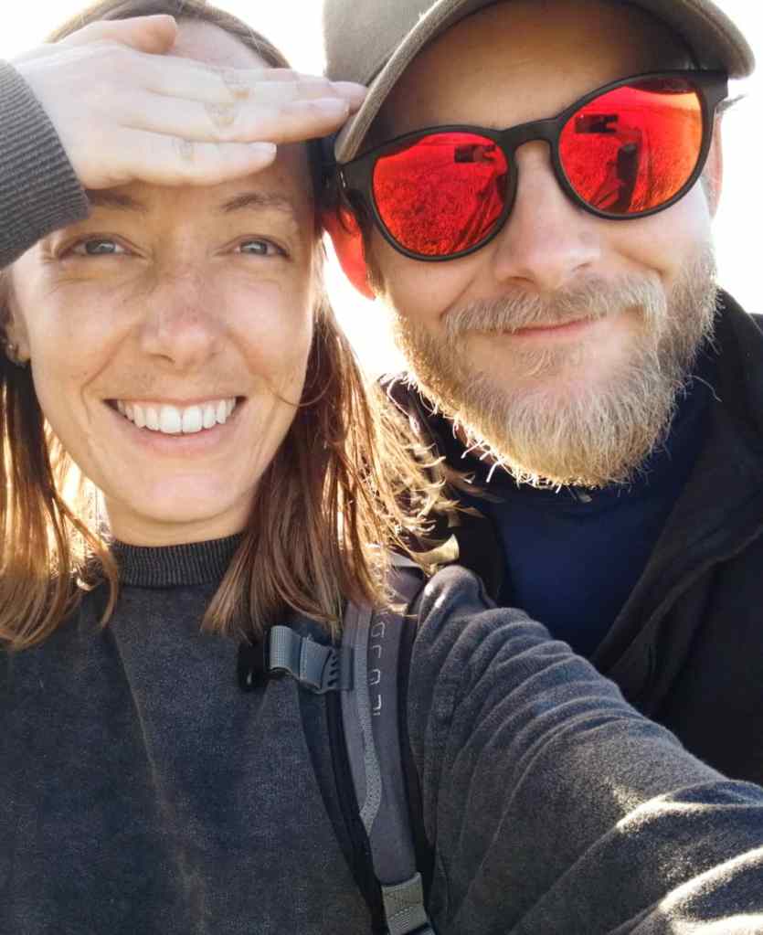
We (Sarah and I) have decided to complete the longest National Trail in the UK, the South West Coast Path. As you may have read here, the path is 630 miles (1015km) long, so we have decided to split it into more time friendly chunks and complete it over a number of long weekends, hopefully in the next 12 months or so.
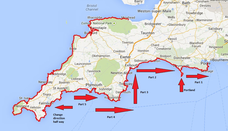
You may or may not be aware that the South West Coast Path runs from Minehead in Somerset to Poole in Dorset. Some people follow that direction and others do it in reverse – Poole to Minehead. We have opted to mix it up a little bit and do it in sections going forwards but in reverse (if you think that’s confusing, try being the person who plans each section!) Our first section, which is what this article is about, was from Portland to the finishing point in Poole. The next section is from Budleigh Salterton, near Exmouth, to Portland, and then we’ll go from our next starting point to Budleigh Salterton and so on. The issue we have by doing that, though, is when we eventually complete the whole path, we won’t actually be in Poole or Minehead. So to make it more confusing for you, at Porthallow in Cornwall (official halfway point), we will then flip our direction and start walking towards Minehead so we finish at the official start/finish point – hopefully that makes sense, I’m confused even writing about it.
So, why are we doing it anyway? I’d love to say it’s because of the beautiful scenery, the challenge and the sense of accomplishment, but it’s pretty much just because we had some spare time, and why not? But I also often complain that people, including myself, leave the UK in search of the natural beauty of foreign lands which can actually be found right here in the UK – you might just need a coat. Therefore, it’s a good opportunity to make the most of what we have and also a good opportunity for me to showcase to you the beauty of what can be found in the UK.
Also a little warning that I’m a bit of a nerd and some parts of this article might seem like a history lesson but just go with it.
So let’s go…
Day 1: 5th July 2020 – Nothe Gardens, Weymouth Harbour, A cannon ball, some hot bikers and a beer
Before we even left home on day one, the plan had changed slightly. The original plan was to start at Portland Bill lighthouse but due to some lunch reservations with Sarah’s dad, time would have been a bit tight and we would instead start just at the edge of Portland Isle, but this didn’t bother us for two reasons:
- People often skip the stretch down to, and back up from, Portland Bill. I’m not sure why because that’s just cheating yourself of 10 miles.
- The lunch was delicious. I would highly recommend The Crab House Cafe near Weymouth if you want some seriously great fresh fish and some bloody massive crab.
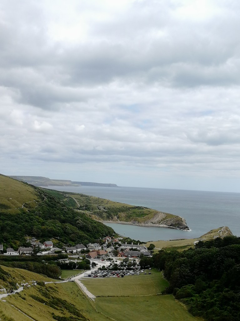
Anyway, lunch was done and we donned our packs and made the first steps of what will eventually be a 630 mile trip. We had seriously lucked out with the weather right from the beginning – the sky was clear enough for us to see right across Portland Harbour, Weymouth Bay and right out towards St Aldhelms Head, a distance of about 18 miles/28 km across the water.

We were also quite unlucky as when the sun comes out it seems the entire nation flocks to the south coast of England – even during a pandemic. So dodging cyclists and trying not to knock down small children and the elderly with my rucksack, we eventually made our way into Weymouth. Day one was now to be the shortest stretch by far over the next couple of days. We had booked a room at The Riviera on the far side of Weymouth in Bowleaze Cove for the night which was now just a short 5 miles away, so we took our time but also rushed through as much of the manic bustle of Weymouth as we could. We were looking forward to getting away from people and getting stuck into the next couple of days where we would have nothing but the rolling Dorset hills to our left, the vast English Channel to our right and just the sound of the water crashing below us. Peace, however, would have to wait for the time being.
We walked through Nothe Gardens on the southern edge of Weymouth, which displayed stunning panoramic views of Portland Isle and Weymouth Bay.

Nothe Gardens then leads down into the old Weymouth Harbour, which is still home to some of the original 17th century Tudor architecture and certainly worth a visit on a quiet day. It’s linked to the main town by a rising bridge. Originally constructed in the late 1500’s and then rebuilt about four times since, it would have originally allowed access into the harbour for steam liners and probably galleons before then but now operates mostly for luxury mega yachts.
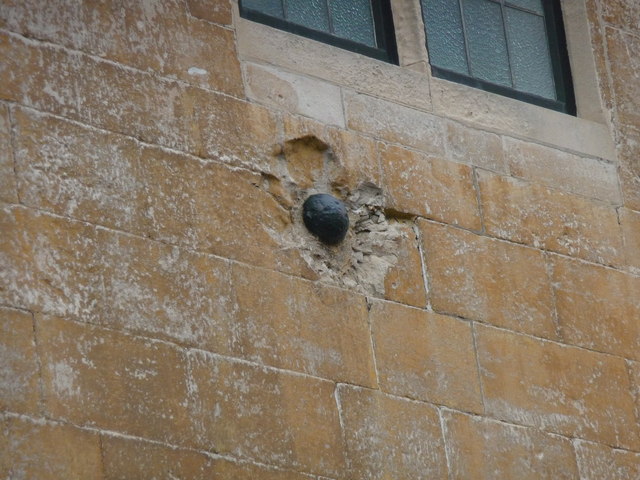
We accessed Weymouth beachfront from Maiden Street, one of the oldest areas of the town where, quite interestingly, you can find a cannon ball, which had been fired during the Civil War in 1645, still lodged in the wall of one of the buildings.
I’ll try not to bore you too much with history throughout this article, but the whole of the South West Coast path is absolutely riddled with the stuff, and I do like history.
The further away you get from the old town of Weymouth the closer you get to the typical ‘bucket and spade’ town. It also seems that the further you get into any town, especially on the beach during a hot sunny day, the more strange looks you get from holiday makers wondering why you have a big rucksack, big boots and hiking kit on – but then I was thinking the same thing about the large number of bikers sweating in their heavy leather kit on the beach.
We could see The Riviera in the distance at the far end of the beach, where sand turns to boulders, and decided not to join any of the queues for some food but to keep going and get sorted later. We had already done a bit of a recce of Bowleaze Cove earlier that day and it’s not exactly a place I would recommend for people to visit, but it does have a good view of Weymouth going for it. We cut down from the path and linked into Bowleaze Cove via the beach.
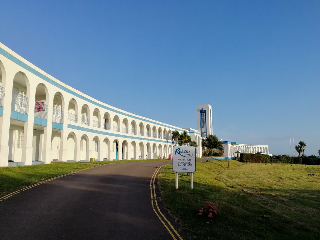
From a distance The Riviera Hotel has an impressive frontage and certainly wouldn’t be misplaced in 1920s Hollywood, or apparently 1930s Weymouth as it seems. Due to the recent COVID-19 lockdown, the hotel had been closed to the public and had been split into two halves. One half was used to house the homeless and the other half housed NHS staff who couldn’t go home. So, even though the place could have done with another renovation, I have to give them the respect they are due for the service they provided. After all, all we really needed was a bed for the night and some breakfast in the morning and both were great.
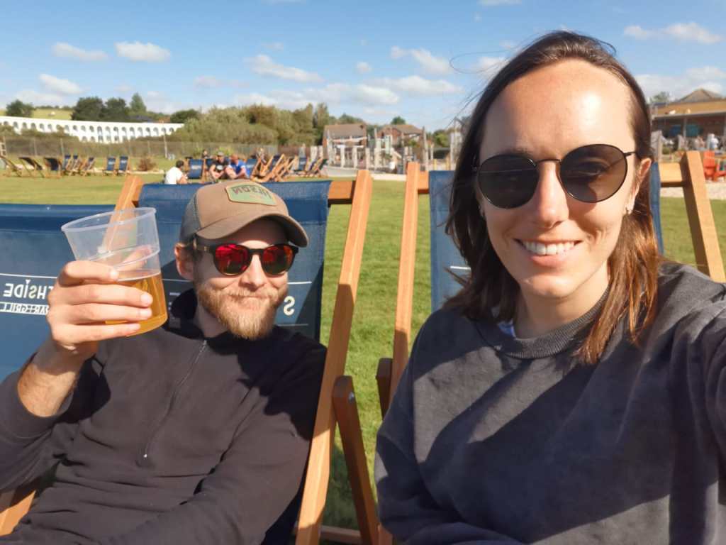
That evening, my preparation for the next couple of days walking was to sit on the beach and enjoy an ice cream and a nice cold beer looking out at the sea. Honestly, I wouldn’t be unhappy if I prepared for all trips like that.
Day 2: 6th July 2020 – Stranded cruise ships, smugglers, Vancouver, tourists and artillery fire
We were on the path by 09:30am after breakfast. We weren’t given a choice of what to eat – it was full English or nothing, which is fine by me but for Sarah, who’s vegetarian, that just meant a few beans and an egg.
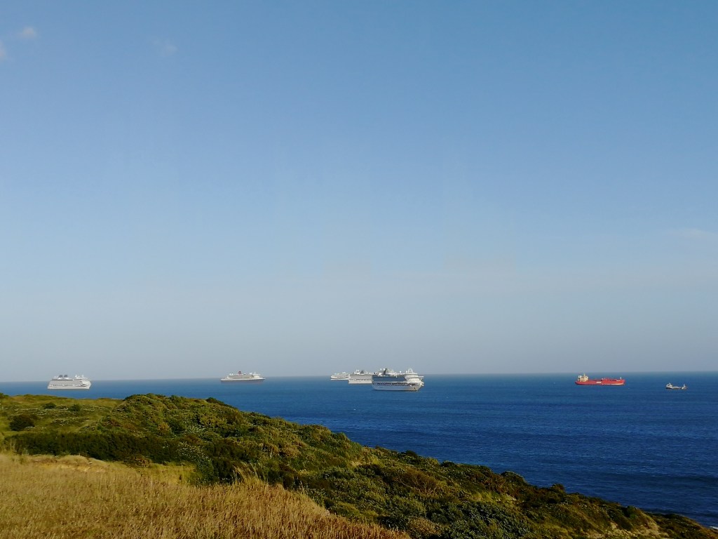
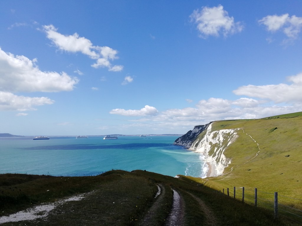
The South West Coast path runs right next to the hotel and immediately up a steep climb, which provides a spectacular view of Weymouth, Portland Isle, Chesil Beach and inland towards White Horse Hill. There were also six cruise ships anchored off shore just outside Weymouth Bay. Due to the current travel restrictions, cruise ships obviously had to find refuge somewhere until they became operational again. After apparently being turned away by many of the UK ports, the Queen Mary 2 and the P&O cruise ships Aurora, Azura, Arcadia and Brittania eventually found a nice spot overlooking Weymouth – with the majority of their staff still on board.
From there it was just a short walk across the hills and cliff edges to the little hamlet of Osmington Mills, home to the 13th century pub The Smugglers Inn which has been one of my favourite pubs for about 10 years after accidentally taking a wrong turn on a cycling trip. The pub was the base of operations for the French smuggler Pierre Latour and the cove where Osmington Mills sits was one of the main landing spots for smugglers in the 17th century. A real hidden gem surrounded by history, quite literally as it sits right at the cliff edge of the Jurassic Coast full of fossils. They also serve a great selection of local ales… Anyway, again, I digress…
Unfortunately, the pub was closed. Apparently drinking that early in the morning is frowned upon anyway, and especially when you have about 20 miles left to cover that day.
The plan for day two was to walk from Bowleaze Cove to Kingston, a lovely little village just south of Corfe Castle, approximately 20 to 22 miles away. However, halfway along the stretch the Path runs through Lulworth Firing Range, used by the Ministry of Defence to train soldiers to blow stuff up with tanks and artillery guns. Apparently it’s quite dangerous to walk through an artillery range when they are firing live rounds (who would have thought), so it’s surrounded by a massive fence and the paths are locked when they are firing. On a side note, the information on the internet isn’t clear in my mind as to when you definitely aren’t allowed through on the designated ‘range walks’. If the gates were locked this would mean a slight diversion up and over the range making our total stretch 27 miles / 43km – a bit of a slog. Our plan was to follow the path to the edge of the range and, should it be locked, then follow our pre-planned diversion path up and over it. We also had a backup ‘evacuation’ route to the town of Wool where we could take a train to save some time if we needed to.
It took no time at all to leave behind the bustle of Weymouth and all the people and find peace and quiet on the path and then the constant singing of a skylark very quickly joined us. I love these little birds and I am certain that they are probably the noisiest little birds known to man, especially considering they are so tiny. The male skylark constantly sings on the wing – as soon as he is up in the air you can guarantee he’ll be singing his little heart out. Apparently, they have a range of about 300 syllables and each skylark has a unique tone. We have an abundance of larks around our home in north Buckinghamshire, and it soon became very apparent this wasn’t going to be the last time we were serenaded by one in Dorset. What also became clear is the number of kestrels living on the south coast. Once we were away from the busy built up areas, almost everywhere we looked, there would be a kestrel hovering above the path or diving through the air around the cliff edge. At one point we even saw one battling with a buzzard.
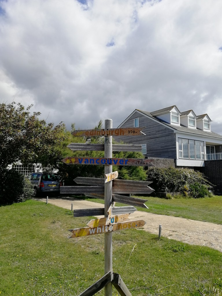
We eventually dropped into a valley and into the village of Ringstead, somewhere we both decided very quickly we wouldn’t mind living at some point, and Ringstead Bay. Other than being just up the shore from a nudist beach, Ringstead Bay has 600 meters of reef just off shore, which is uncovered at low tide. The beach is also protected by the National Trust, which I don’t see as a bad thing at all. In the front garden of one of the many beautiful houses along the coastline in Ringstead the owner has built a mile post pointing to numerous cities around the world. One in particular, right at the front, was Vancouver, 4705 miles away. One of the most amazing places we’ve been to together. We were due to land in Vancouver in September as part of a holiday we’ve had to cancel, so sadly, 4705 miles was probably the closest we were going to get to Vancouver this year.
Just outside of Ringstead as you follow the coast path, on the left is a wooden structure which looks like a big shed but is actually a church. This, however, is not the original church as the original, along with the original village of Ringstead, mentioned in the Domesday Book, was abandoned and crumbled after the Black Death hit the area in 1348.
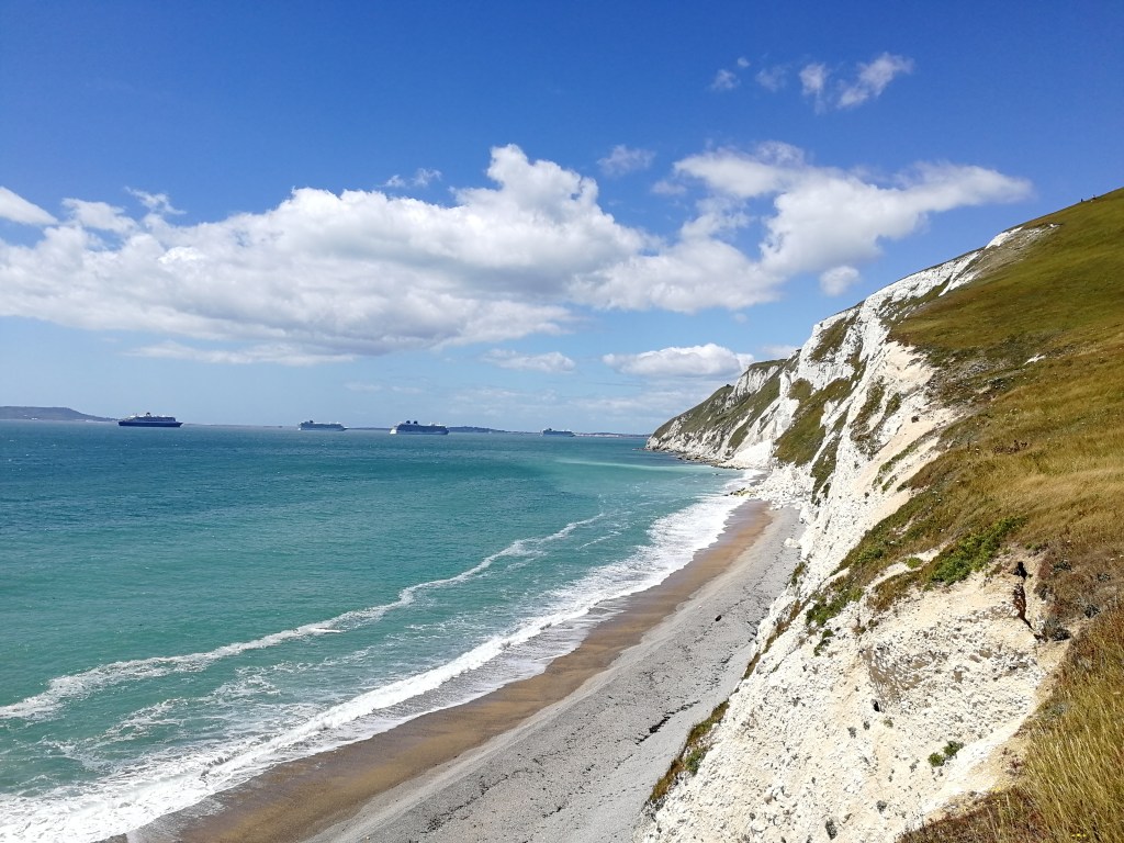
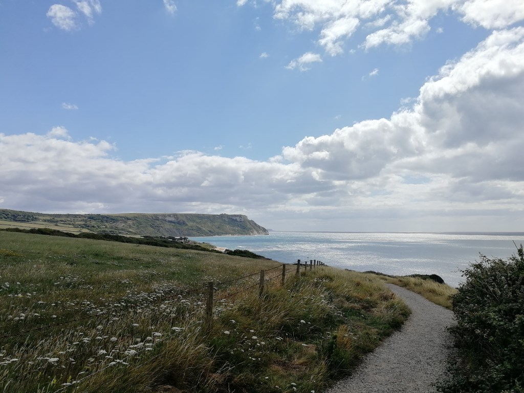
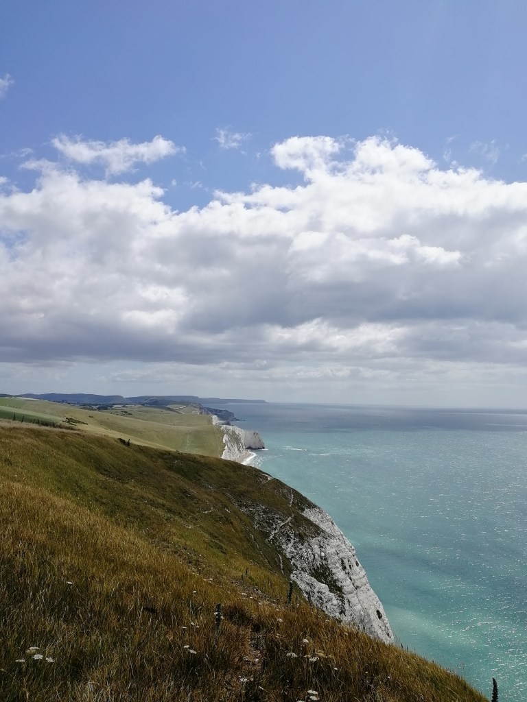
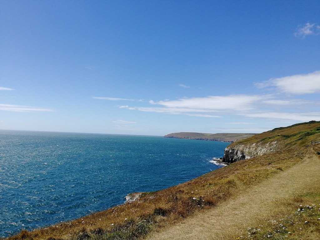
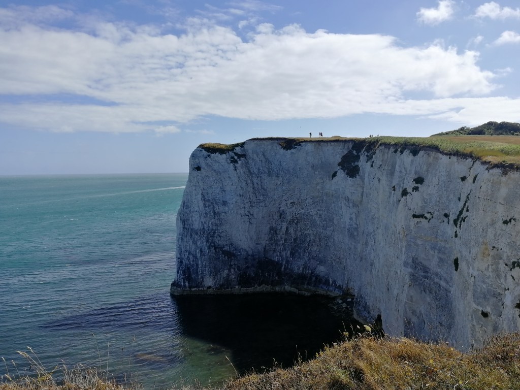
Between Ringstead and Lulworth Cove is one of the most spectacular parts of the UK coast I have ever seen. With enormous white cliffs and coves, surrounded by the almost crystal clear turquoise sea, every typical image you see of The Jurassic Coast comes to mind. Other than some of the mountains we’ve done, parts of this stretch are also some of the more challenging bits of walking I’ve done, with near vertical climbs – and this part of the South West Coast path is supposed to be easiest.
Atop a couple of the largest hills you find some old terraced cottages which used to belong to the Coastguard but are now probably holiday homes with the most amazing view straight over the English Channel.
Obviously as we got closer to some of the most popular parts of the Dorset coast – Durdle Door and Lulworth Cove – we started to see more and more people. We refilled our water in Newlands Farm, a huge camping and caravanning site just north of Durdle Door and then re-joined the path to overlook the iconic limestone arch. Durdle Door was a site that Sarah had always wanted to see but quickly it seemed the magic and excitement she had was lost as she thought it was ‘just something you walk past’ not, as it is now, a highly popular tourist attraction. The same could also be said for the beautiful little fishing village in Lulworth Cove.
Lulworth Cove is scattered with evidence that fishing still occurs there, however the crab and lobster cages perfectly stacked down the road down to the cove reminds me of what Raynor Winn experienced in Cornwall whilst writing about her time on the South West Coast path in the amazing book The Salt Path. Whilst she was speaking to a man stacking some of the lobster cages in a small Cornish village, he informed her that he wasn’t actually a fisherman, doesn’t like going out on boats and the cages were just for show because ‘that’s what the tourists liked’. I was pretty sure this was also the case in Lulworth Cove – ‘Just for the “grams”’ as Sarah remarked. I believe that’s a reference to Instagram.
I am in no way saying these beautiful and spectacular places are not worth a visit. I would just recommend going out of season to avoid the crowds. The whole coastline there is incredible and I in no way want to detract from that.

Just the other side of Lulworth Cove we could see the firing range fence line which would determine the next half of our walk for the day. Actually, we realised we probably wouldn’t be able to go through the firing range about 2 miles beforehand when we heard the sound of rapid gunfire and artillery. We reached the fence line and saw the red flags hoisted high on a pole with red lights flashing on top, the double gate well and truly locked and signs which read:
Military Firing Range
KEEP OUT
And written in a wasp like yellow and black warning, something along the lines of:
Do not touch any military debris.
It may explode and kill you.
It was definitely time to follow our pre-planned diversion. Leaving the coast path and joining sections of The Hardy Way, accompanied by the sound of gunfire for the next couple of hours, we reached our next decision point. The ‘evacuation’ route would be used if time was critical – ‘critical’ meaning we’d get to the pub after they stopped serving food. The footpath leading through Coombe Heath Nature Reserve right on the edge of the firing range splits into two directions. Left was the evacuation route to Wool and the train, or right for an extra 9 or 10 miles to our finishing point for the day. It was already getting late in the day and we discovered the pub stopped serving dinner at 8pm so our stomachs made the decision for us. What would have been another 3 hours or so of walking, miles away from the coast path, we completed in about 20 minutes thanks to South Western Railway. We took the train from Wool to Wareham and then ‘Everest Taxis’ to Kingston for dinner and bed. It was very apparent that ‘Everest Taxis’ named themselves after their sky high fees…
It felt like cheating, but we still completed about 20 miles on day two thanks to our route to the train station in Wool. After all, we came to walk the South West Coast Path, and it just wasn’t possible to continue through the firing range – and we didn’t get blown up, so that’s fine.
I prepared for day three, which was to be the longest of the three days, in the only way I knew how. I spent about 10 minutes reviewing the maps with a nice cup of tea, and then finished off my preparation with fish and chips and a large glass of Pinot Grigio in the pub garden overlooking Corfe Castle, and beyond that Brownsea Island and Poole Harbour, where we would conclude our 3 days of walking.
Day 3: 7th July 2020 – Castles, lighthouses, spectacular views, exercise smash, paddling in the sea and then the ferry
Day three started early again with a quick breakfast, plenty of coffee and stiff legs after forgetting to stretch everything out at the end of day two. Our home for the night, The Scott Arms in Kingston, easily has the best view from a pub garden in my eyes. Straight down the Purbeck Hills, over Corfe Castle and beyond.

Kingston is nestled in a perfect little spot surrounded by hills, woodlands, history and just a short stroll down the valley to the coast path. Everything somebody like me would want. We re-joined the Coast Path at St Aldhelms Head at the top of a very steep climb of steps leading from Emmett’s Hill. At St Aldhelms Head sits a very intriguing little stone Norman chapel, aptly named St Aldhelm’s Chapel. The build date is unknown but the records of the chapel go as far back as the early 1200s, during King Henry III’s reign.

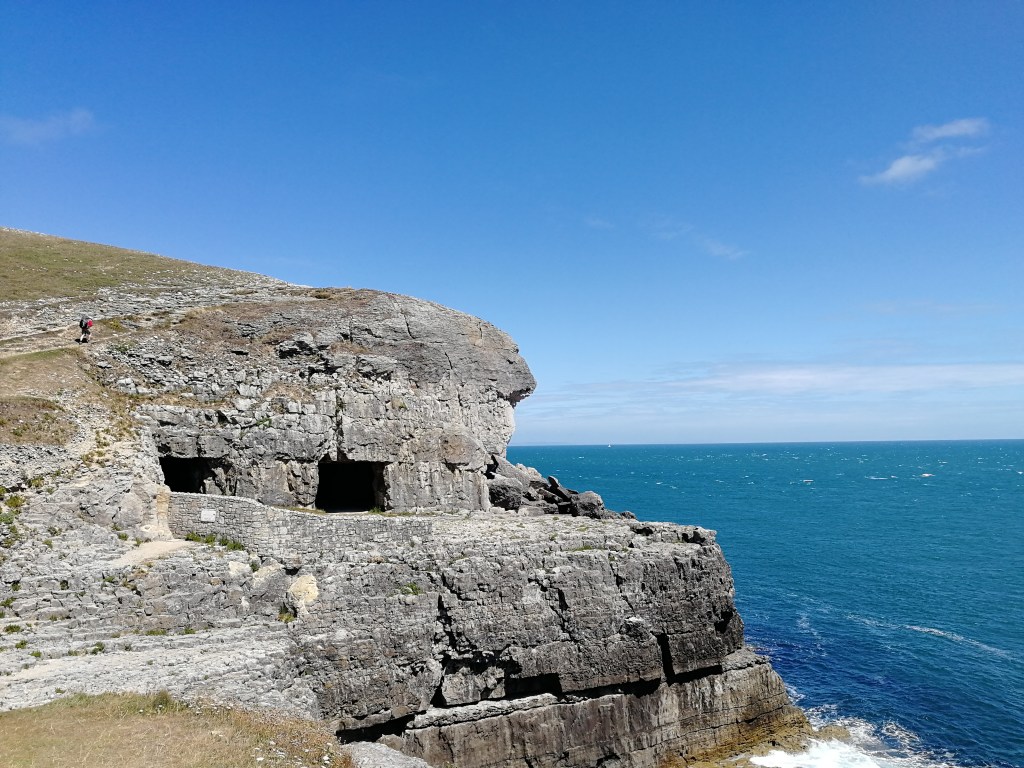
From St Aldhelms Head the path takes you further and further away from any local civilisation and runs close enough to the edge of the 100m (plus) high cliffs that Sarah would keep pulling me back from or telling me to ‘get back from the edge!’ of every few minutes. Some of the drops are quite impressive though! The path drops down into the disused Seacombe Quarry, full of little caves and old abandoned stone buildings and foundations.
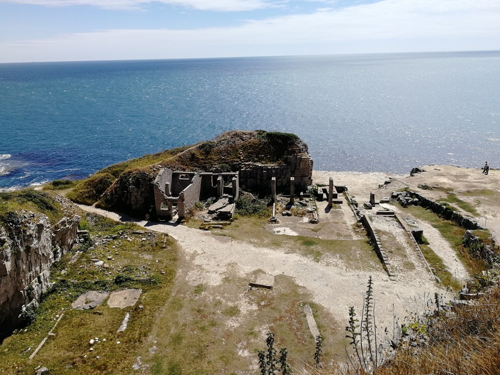
The quarry is worth a look around but should be treated with caution, reiterated but the numerous large warning signs that the very loose limestone walls are quite fond of crumbling and dropping enormous rocks.
That didn’t stop a number of rock climbers who were clinging to the walls as we walked through. Just along the path from Seacombe Quarry is Dancing Ledge, another disused quarry, named after the way the waves ripple and dance across the ledge at a particular time of day. We didn’t see much dancing but there were a few people down there using it as access for a swim. Swimming at Dancing Ledge isn’t recommended these days as the current has been known to pull people below the rock shelf and drown them, but back in the early twentieth century a swimming pool was blasted into the shelf there for the local school to use. It’s been destroyed since, but that would have been an intense swimming lesson. There’s no stopping some people though, and to be fair, I’d probably give it a go too.
From back on St Aldhelms Head I had spotted a couple of large metal pylons along the path in the distance and picked one as an ideal spot for us to have a quick 20 minute rest, roughly halfway along our last stretch. They then vanished for a couple of hours and reappeared not long after Dancing Ledge. If you were to look on an OS Map, you can find these pylons labelled as Mile Indicator Posts. They weren’t something I’d come across before, and were literally just two tall metal pylons, one just behind the other. After a bit of research, I’ve discovered that these are quite common occurrences along the coast and many other waterways, even appearing on the River Thames. The mile is measured from the point the pylons perfectly line up and ends a mile down the coast at the next set of posts. Boats and ships still use these posts to measure their speed against the fluctuating currents. It was at this break spot that we saw a kestrel battling a buzzard before diving down the cliff edge and appearing further down the path in the direction we had just come from.
It was also at this spot that I checked the map and realised the posts I chose as our lunch spot were actually the second set of posts a mile away, just above Tilly Whim Caves.
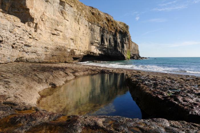
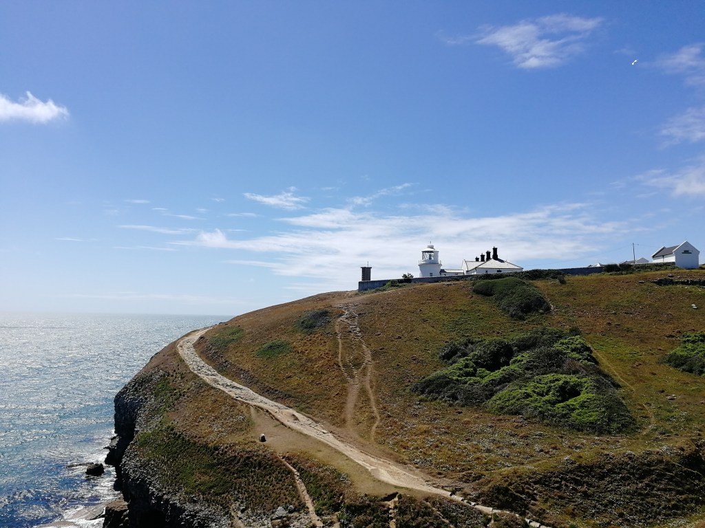
The caves are also, like many other points on this stretch, the remains of an old quarry used to extract Purbeck Stone many years ago. They were once open as an attraction but are now closed to the public due to rock falls. The caves look across a little inlet towards the small Anvil Point Lighthouse, a site of special scientific interest. It was once fitted with an explosive fog horn that would sound when it was foggy (obviously) every 5 minutes, which must have really pleased the locals in the middle of the night.
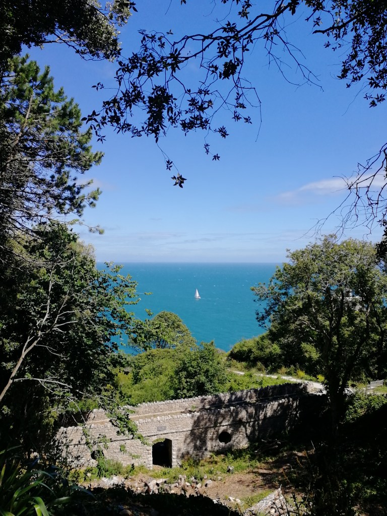
The Mile Indicator Posts above the caves also marked the point for us where the rolling grass hills would turn into the hustle and bustle of Swanage. We also knew that the steep hill climbing out the north end of Swanage was the very last climb we had to do, meaning the end of our little adventure along this stretch of the South West Coast Path was almost in sight. Just before you get into Swanage though, you walk through the grounds of Durlston Castle which, through the frame of the trees along the small woodland path, you wouldn’t be blamed for thinking you were somewhere in the Mediterranean, looking down at boats sailing on the turquoise water under the blaring sun.
Linking back to the rather dull subject of quarrying, Durlston Castle was built by the man who was responsible for much of the quarrying and after destroying large sections of the natural coastline, he wanted to give something back to the locals and built himself a nice little castle. Very thoughtful…
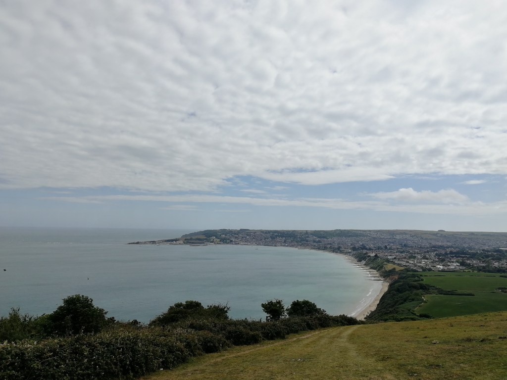
Much the same as we did in Weymouth, we rushed through Swanage as quickly as possible. From a distance, the climb leading up to the cliff above Swanage looked horrible, but once we were on it the climb was very gradual and we more or less ran up it. The view from the top, looking over Swanage and the Purbeck Hills is particularly good. I often say the further away you get from a town, the nicer it looks, and the view from the top of that hill was a good example of that.
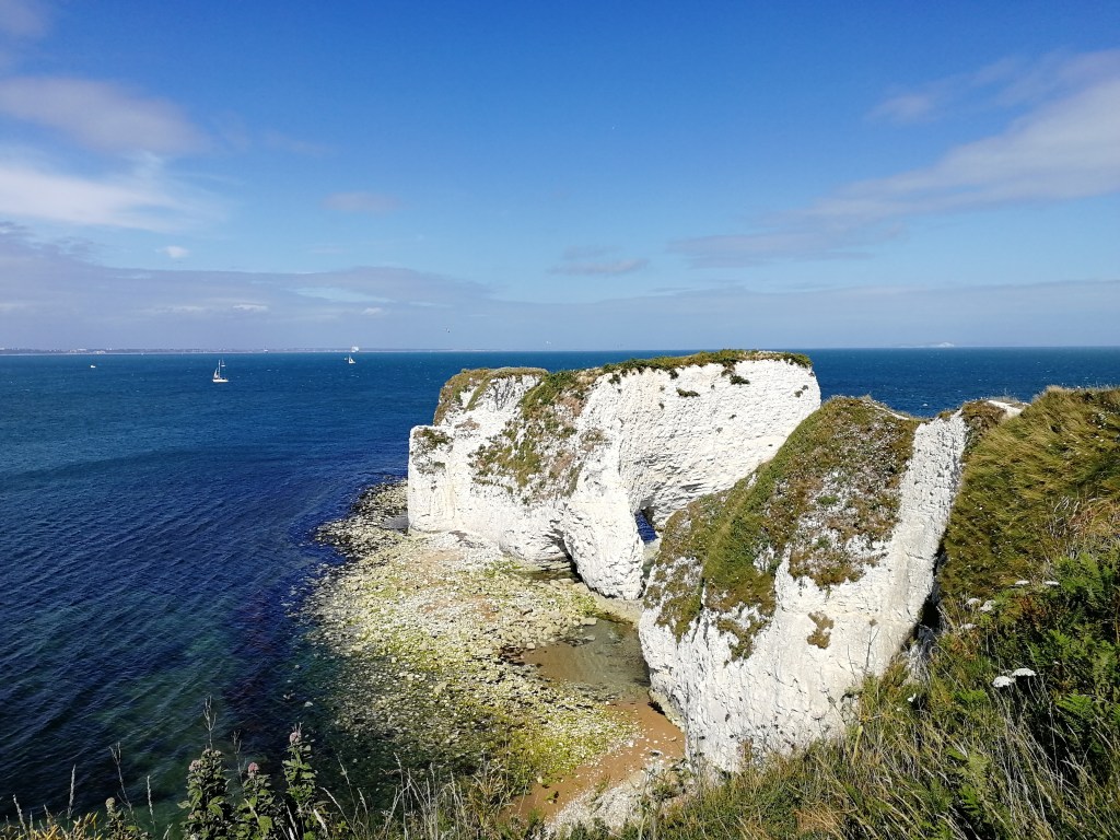
On the other side of the hill, along from Ballard Point, is Old Harry Rocks, one of the other most popular sites along the Dorset Coast. With its enormous chalk cliff faces and eroded arches, it’s reminiscent of The Needles on the Isle of Wight and for very good reason. Old Harry Rocks is the remains of what, once upon a time, used to be a long stretch of chalk connecting to the Isle of Wight some 15 miles away. The Needles on the Isle of Wight are the remains of that end of the chalk bridge. The origins of who Old Harry is, though, is a bit of a mystery. There are a few legends surrounding the origins like Harry Paye, a famous pirate from Poole who used to keep his ship hidden behind the rocks. Another legend says that the devil, who is apparently also known as Old Harry, used to sleep on the rocks, but who knows? Whoever Harry is, he has some pretty good rocks and some pubs named after him.
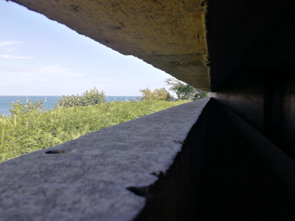
Almost 18 miles from our starting point that day, we hit the home straight – the very nice long sandy beach of Studland Bay. ‘Did you know that Coldplay filmed the video for their song ‘Yellow’ on this beach?’ is often a question we ask of each other when we walk on the beach as it’s a fact Sarah’s dad has told us nearly every time we go there. Good music video though. What’s even more impressive about Studland Bay, though, is that we trained for D-Day landings there and the concrete bunker where Churchill observed the training is still standing, along with various other heavy gun bunkers and Dragon’s Teeth tank traps. The training operation was named Exercise Smash. They also set fire to the sea by pouring gallons of crude oil on it and, I like to think, Churchill probably dramatically flicked his cigar onto it. Imagine trying to get that mess off a poor unsuspecting seagull…
Once on the sand, I immediately removed my boots, rolled up my trousers and went for a bit of a paddle. There is no better feeling that getting your feet out of big hiking boots after three days and letting them soak in the cold water. I did, however, forget that the beach was nearly about 2 miles long. You’d think after walking nearly 50 miles, walking those final 2 miles on the beach with your boots hanging from your rucksack would be quite nice, but I soon realised it wasn’t the best feeling in the world and was better off getting them back on.
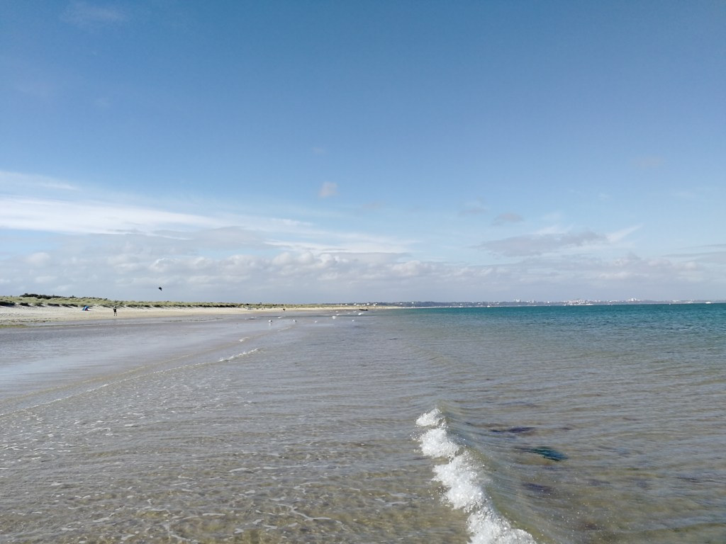
At the far end of Studland Bay is South Haven Point, the official finishing post of The South West Coast Path and where we stepped aboard the chain ferry across to Poole Harbour to eventually go home.
The closer we got to the end of our little adventure the less excited we felt about finishing it. Our time on the path had come to an end for the time being and we felt like we could have done another 50 miles straight away, spending a few more days walking the coast path. The idea of having to stop at that point did make us a bit sad. We were really proud of ourselves and what we had achieved in two and a half days, but we weren’t ready to stop. So, as soon as we got home, I plotted the next section for us to complete.
580 miles left to go.